MAPPING UNCERTAIN LANDSCAPE:
THE SATELLITE
Witnessing changes in the Ukrainian landscape: surveilling, tracking and targeting, diagramming, drawing, and redrawing the segments of Ukrainian terrain using a map-making machine.
The installation explores the relationship between humans and machines, the map maker, and the map. Looking closer at the remote-sensing infrastructures, and their problematics. As well as questioning maps and mapping processes all in order to sense changes in the landscape that are occurring daily due to the current war in Ukraine.


When I went to Kyiv in August of 2022,
my eyes were peeled to the landscape.
I needed the see, what has changed.
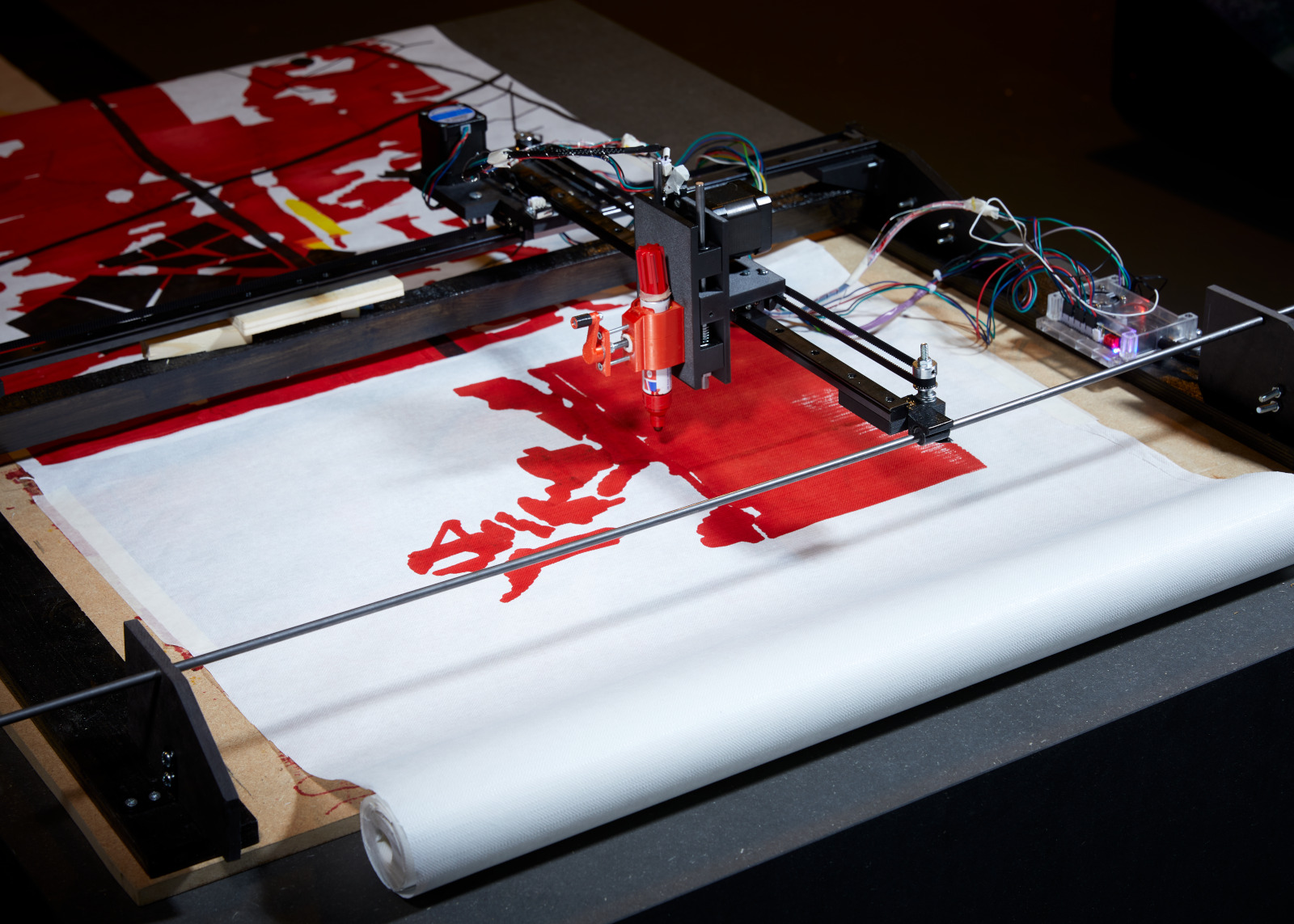
In order to do that I built a map-making machine, a forever watchful eye:
focusing on a specific location: this road between Ivankiv and the Belarus border,
50 km from Chornobyl’s Zone of Exclusion. 90km to Kyiv.
my eyes were peeled to the landscape.
I needed the see, what has changed.
In order to do that I built a map-making machine, a forever watchful eye:
focusing on a specific location: this road between Ivankiv and the Belarus border,
50 km from Chornobyl’s Zone of Exclusion. 90km to Kyiv.
I also created a film to give a theoretical and general overview of the project.

I started with building a machine, a metaphorical satellite, hovering above the land,
mapping the data with a limited amount of accuracy, transforming satellite
images into maps of the territory. I became interested in the relationship
between humans and the machine.
Thinking through technology and understanding concept better
through software and hardware.
Converting satelitte data into GCODE
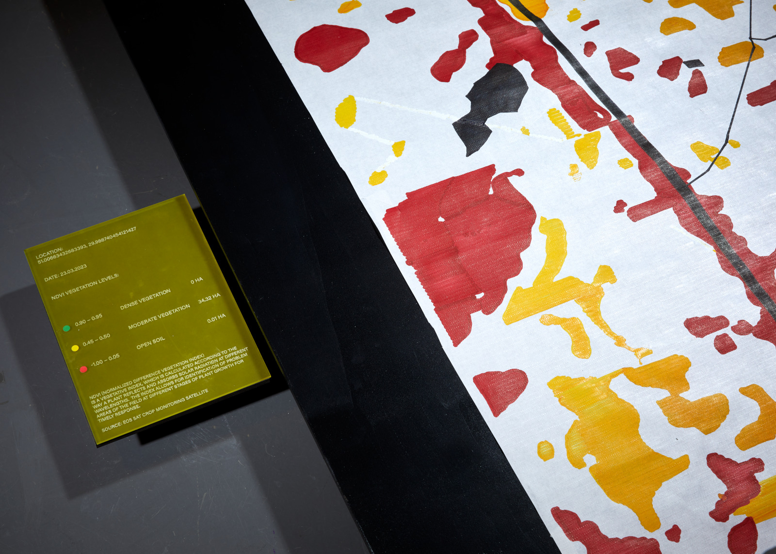
This type of data that is being printed is called NDRE (Normalized Difference RedEdge) and is an indicator of the photosynthetic activity of a vegetation cover used to estimate
nitrogen concentrations in plant leaves in the middle and at the end of a season.
It allows you to detect the oppressed and aging vegetation and is used to identify plant
diseases.
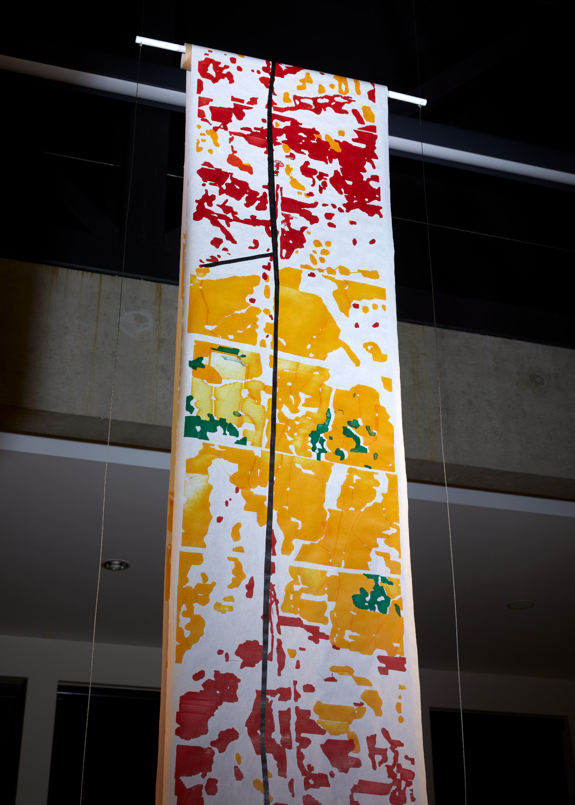
The machine is translating this information into colors (red, green, and yellow).
It can draw landscapes: it ca reveal trees, fields, and hedges, life growth, recovery,
and renewal.